Drones play a crucial role in habitat mapping by providing high-resolution aerial images and real-time data. You can cover large areas quickly while reducing disturbance to wildlife. They allow you to track vegetation patterns and monitor habitat changes over time. With advanced sensors, drones improve data accuracy and help identify essential animal habitats. This technology makes exploring challenging terrains easier and enhances conservation efforts. Keep exploring to discover how drones are revolutionizing ecological research.
Key Takeaways
- Drones facilitate high-resolution aerial surveys for accurate habitat mapping, transforming traditional data collection methods.
- They provide real-time data, enabling researchers to monitor ecosystems and track habitat changes efficiently.
- With advanced sensors, drones assess vegetation patterns and soil conditions, enhancing ecological understanding.
- Drones can access challenging terrains, gathering data from previously unstudied or hard-to-reach locations.
- Non-invasive wildlife monitoring via drones helps identify animal populations and behaviors, informing conservation strategies.
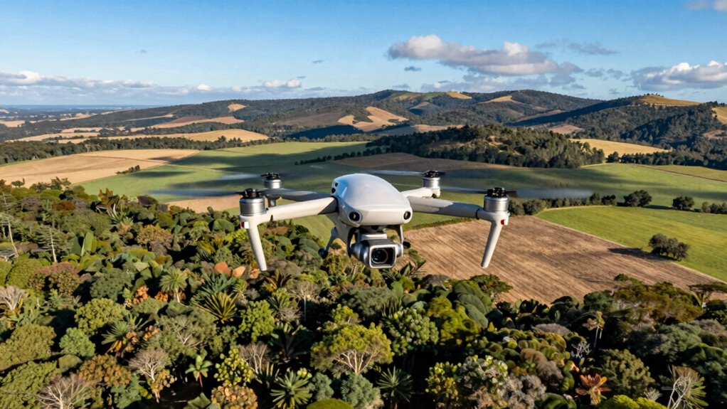
As technology advances, drones have become essential tools in habitat mapping, transforming how researchers gather data. You might not realize it, but these flying devices are revolutionizing habitat conservation efforts across the globe. With drone technology, researchers can conduct aerial surveys that provide high-resolution images and real-time data, making it easier to monitor various ecosystems.
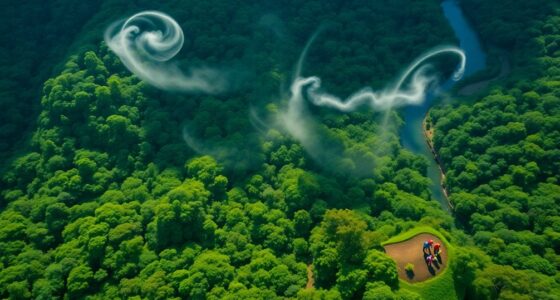
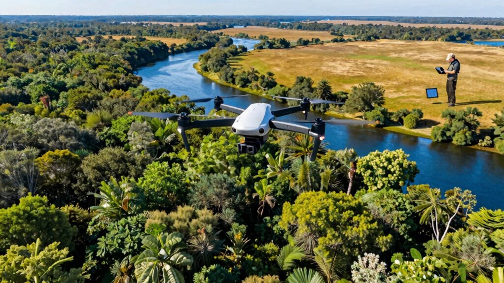
Imagine you’re a researcher tasked with studying a remote area. Traditionally, you’d have to hike through rough terrain, collecting samples and recording observations by hand. This process can be time-consuming and physically demanding. However, by utilizing drones, you can quickly cover large areas and gather detailed information without disturbing the wildlife or environment. Drones enable you to capture aerial imagery that reveals vegetation patterns, water bodies, and other vital habitat features that might be invisible from the ground.
Imagine swiftly mapping remote areas with drones, capturing vital habitat details while minimizing disturbance to wildlife and the environment.
One of the most significant advantages of using drones in ecological monitoring is their ability to collect data efficiently. You can program a drone to fly specific routes, capturing images at regular intervals. This systematic approach allows you to gather consistent data over time, making it easier to track changes in habitats. With advanced sensors and cameras, you can even monitor plant health, soil conditions, and more. This data collection method enhances your understanding of ecological dynamics and helps inform conservation strategies.
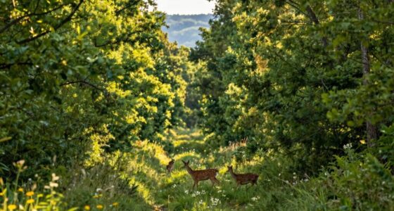
Wildlife tracking has also benefited from drone technology. You can use drones to monitor animal populations without invasive methods. For instance, you can identify nesting sites, migration patterns, and behaviors, all while minimizing your impact on their habitats. By analyzing the data collected from these aerial surveys, you can develop effective conservation plans that prioritize the species and areas most in need of protection. Additionally, remote sensing capabilities are further advancing the accuracy and scope of habitat analysis, allowing for more comprehensive ecological assessments.
Moreover, drones can cover areas that are challenging for ground teams to access, such as dense forests or steep terrains. This capability means you can gather essential data from places that might otherwise remain unstudied, improving your overall knowledge of biodiversity in those regions.
Incorporating drones into habitat mapping not only streamlines the research process but also enhances accuracy. By embracing this technology, you’re contributing to the future of habitat conservation, ensuring that ecosystems are monitored, preserved, and protected for generations to come. Whether you’re a researcher or an enthusiast, understanding drone applications can deepen your appreciation for the natural world and the efforts to conserve it. Additionally, advancements in smart IoT technologies are further enhancing data collection and analysis, making habitat monitoring more precise and accessible.
Drone with Camera – Drone with Screen on Controller for Beginners, Foldable Remote Control Quadcopter with Gesture Control, 3D Flip, One Key Start, Emergency Stop, 2 Batteries, Easier to use
The PK01 drone's remote comes with a super handy built-in screen—no phone needed—so you can watch live HD…
As an affiliate, we earn on qualifying purchases.
As an affiliate, we earn on qualifying purchases.
Frequently Asked Questions
What Types of Drones Are Best for Habitat Mapping?
For habitat mapping, you’ll want to contemplate fixed-wing drones and multirotor drones. Fixed-wing drones excel in covering large areas quickly, while multirotors offer high mapping accuracy in smaller regions. Both types can be equipped with advanced sensors for detailed data collection. If you’re focusing on precision, look for drones with high-resolution cameras and LiDAR capabilities. Choosing the right drone type will enhance your mapping accuracy and overall effectiveness in gathering habitat data.
Are There Legal Restrictions for Using Drones in Habitat Mapping?
When you’re flying high with drones, you’ve got to keep your feet on the ground regarding legal restrictions. There are various regulations you need to follow, especially concerning regulatory compliance and privacy concerns. You’ll want to check local laws and guidelines, as they can vary widely. Always guarantee you’re respecting people’s privacy while mapping habitats, or you might find yourself in hot water. Stay informed to avoid any legal hiccups!
How Much Does It Cost to Use Drones for Habitat Mapping?
Using drones for habitat mapping can cost anywhere from a few thousand to tens of thousands of dollars. Cost factors include the type of drone, software, and data analysis services you choose. Technology advancements have made it easier to find affordable options, but investing in quality equipment often pays off in the long run. You’ll want to reflect on both initial costs and ongoing expenses for maintenance and training when planning your budget.
Can Drones Collect Data in Adverse Weather Conditions?
Drones can be like stubborn birds, braving the storm, but they’re not invincible. While they can collect data in light rain or mild winds, severe weather limitations can ground them. You’ll often find that data accuracy takes a hit in turbulent conditions, leading to unreliable results. Knowing when to fly and when to stay grounded is key. So, always check the forecast before sending your drone into the wild!
What Training Is Required to Operate Drones for Habitat Mapping?
To operate drones for habitat mapping, you need proper drone certification, which often involves passing written and practical exams. You’ll learn essential mapping techniques, like using GPS and photogrammetry, to collect accurate data. Familiarizing yourself with software for analyzing the data is also vital. Hands-on experience is key, so consider training programs or workshops that focus on both drone operation and habitat mapping to guarantee you’re well-prepared for the task.
advanced sensors for ecological research drones
As an affiliate, we earn on qualifying purchases.
As an affiliate, we earn on qualifying purchases.
Conclusion
In the end, it’s ironic that while drones soar high above, mapping habitats with precision, they also remind us of our grounded reality—our need to protect these delicate ecosystems. You might think technology distances us from nature, but in truth, it brings us closer, revealing hidden wonders and vulnerable spaces. So, as you marvel at the stunning aerial views, remember: these flying machines aren’t just capturing landscapes; they’re calling us to care for them.
THE WILDLIFE DRONE MONITORING HANDBOOK: A Beginner’s Guide to Drone-Based Conservation, Animal Tracking, and Habitat Protection
As an affiliate, we earn on qualifying purchases.
As an affiliate, we earn on qualifying purchases.

DronePoints – Black Aerial Target Kit (Complete) – 12" Diameter – 20 Pack – Ground Control Target & Stencil System for Drone Mapping & Survey
Complete Kit Includes – 20 Aerial Targets, 20 adhesive-backed center markers, 20 60D nails, 1 removal handle, 1…
As an affiliate, we earn on qualifying purchases.
As an affiliate, we earn on qualifying purchases.